Geographic Information Systems (GIS) and Google Maps are two well-known tools in the world of mapping and spatial data. Although they may seem similar at first glance, their purposes, functionalities, and target audiences are quite different. Understanding how GIS is different from Google Maps can help both professionals and everyday users make informed decisions about which tool is best suited for their needs.
GIS is a powerful tool used by professionals for detailed spatial analysis and complex data processing, while Google Maps is primarily designed for everyday users looking for navigation or location-based services.

What Is GIS?
GIS, or Geographic Information System, is a framework for gathering, managing, and analyzing spatial and geographic data. Unlike simple mapping tools, GIS combines location data (where things are) with descriptive information (what things are). This combination allows for powerful analysis, modeling, and visualization of geographical information in ways that reveal patterns, relationships, and trends in the data.
How GIS Works
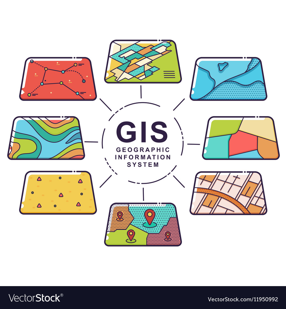
GIS collects data from various sources such as satellites, GPS devices, and manual surveys. This data is organized into layers that can represent anything from roads and rivers to population density or land use. GIS software allows users to manipulate, analyze, and visualize these layers in ways that are both highly customizable and incredibly powerful.
Types of Data in GIS
GIS relies on two main types of data:
- Spatial Data: Information that describes the physical location and shape of geographical features (such as buildings, rivers, or mountains). This data is usually represented in two formats:
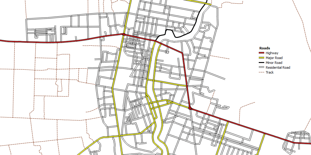
- Vector Data: Points, lines, and polygons that represent objects like cities, roads, or land parcels.
- Raster Data: Pixelated data (such as satellite images) that represent continuous features like elevation or temperature.
- Attribute Data: Additional information linked to spatial data. For instance, a vector layer representing cities could have attribute data describing population size, average income, or demographic details.
Applications of GIS
GIS is used in a wide variety of industries for tasks that require spatial analysis and data visualization. Some common applications include:
- Urban Planning: Assessing land use, zoning regulations, and infrastructure development.
- Environmental Management: Monitoring wildlife populations, tracking deforestation, or managing water resources.
- Disaster Management: Analyzing the impact of natural disasters and planning evacuation routes or resource allocation.
- Public Health: Mapping disease outbreaks, managing healthcare infrastructure, or analyzing environmental health risks.
Key Features of GIS
GIS offers a range of powerful features that make it indispensable for professionals working with spatial data:
- Advanced Data Analysis: GIS allows for sophisticated spatial analyses, such as calculating proximity, overlaying multiple layers, and detecting patterns.
- Custom Mapping: Users can create highly detailed, multi-layered maps tailored to specific needs.
- Data Integration: GIS can integrate various types of data from multiple sources, allowing for comprehensive analysis.
- Geoprocessing Tools: Functions like buffering, interpolation, and raster analysis enable users to manipulate data and extract valuable insights.

What Is Google Maps?
Google Maps is a web-based mapping service developed by Google that provides a variety of location-based services, including navigation, route planning, real-time traffic updates, and local business information. It is one of the most widely used tools for everyday mapping needs, offering an intuitive and user-friendly interface that makes it accessible to anyone with an internet connection or a smartphone.
Unlike GIS, which is a tool primarily for professionals in fields like urban planning or environmental science, Google Maps is designed for the general public. Its primary purpose is to help users navigate their surroundings, find places, and explore local businesses and points of interest. While it lacks the advanced analytical capabilities of GIS, it is incredibly effective for simple tasks like getting directions or finding nearby services.
How Google Maps Works
Google Maps works by leveraging a combination of GPS (Global Positioning System), satellite imagery, and real-time data from users to provide accurate and up-to-date maps. When you use Google Maps to search for a location or get directions, the app or website connects to Google’s massive database of geographic information, which includes roads, landmarks, and points of interest.
Google Maps also relies on user-generated content. For instance, users can add reviews, upload photos, and suggest changes to improve the accuracy of the maps. The service also pulls data from local businesses and municipalities to provide real-time information, such as store hours, traffic conditions, and transit schedules.
Features of Google Maps
Google Maps is packed with features that cater to everyday users, including:
- Navigation: Offers step-by-step directions for driving, walking, biking, and using public transit.
- Real-Time Traffic Updates: Uses data from millions of users to provide live traffic conditions, showing delays, accidents, and alternative routes.
- Local Search: Allows users to search for nearby restaurants, hotels, gas stations, and more.
- Street View: A feature that provides panoramic images of streets, allowing users to virtually explore locations at ground level.
- User Contributions: Google Maps relies heavily on user-generated content like reviews, photos, and business updates to enhance its database.
Common Uses of Google Maps
While Google Maps is not equipped for the advanced spatial analysis that GIS is capable of, it excels in offering practical, real-time data that is useful for everyday life. Some of the most common uses of Google Maps include:
- Navigation: One of the most popular features of Google Maps is its ability to provide turn-by-turn navigation for drivers, cyclists, and pedestrians. With real-time traffic data and the ability to reroute based on current conditions, it’s an essential tool for anyone on the move.
- Local Business Search: Whether you’re looking for a nearby restaurant, gas station, or retail store, Google Maps makes it easy to find businesses based on your location.
- Exploration: Users can explore different regions, cities, or landmarks around the world, thanks to Google Maps’ detailed satellite views and Street View functionality.
- Public Transit Information: In many cities, Google Maps provides real-time transit schedules and can help users navigate public transportation systems efficiently.
Google Maps also plays a crucial role in business operations. Many companies use Google Maps’ data for location-based marketing, helping users find their business based on proximity or interest. Additionally, Google Maps offers a robust API for developers who want to integrate its mapping data into their applications.
Key Differences in Purpose
- Google Maps is primarily designed to help users find places, navigate routes, and explore local businesses in a simple, easy-to-use interface.
- GIS, on the other hand, serves a much broader and more technical purpose, allowing for complex spatial analysis and decision-making based on layered geographic data.

While GIS and Google Maps both deal with geographic data and mapping, the key differences between the two come down to purpose, data complexity, audience, and capabilities. Understanding these distinctions helps clarify when to use each tool and what its respective strengths are.
Data Complexity
One of the most significant differences between GIS and Google Maps lies in the complexity of the data they handle.
- GIS: GIS platforms can manage and analyze large, complex datasets. These datasets often include multiple layers of information, such as demographic data, land use, climate information, and transportation networks, all of which can be combined to uncover relationships and trends. For example, an urban planner may use GIS to assess the relationship between traffic patterns, residential zoning, and environmental impact. In GIS, users can overlay various data types, such as socioeconomic data on a map, and perform deep spatial analyses that reveal insights like proximity, density, and spatial correlations.
- Google Maps: In contrast, Google Maps is designed to handle simpler, more accessible data. It focuses on offering basic geographic information such as roads, buildings, and points of interest. Google Maps excels in presenting visual maps, but it lacks the ability to perform advanced data manipulation or spatial analysis. While you can search for a location or get directions, the underlying data is static and can’t be customized or analyzed in the same way that GIS allows.
Example of Data Complexity
| Feature | GIS | Google Maps |
|---|---|---|
| Data Layers | Multiple complex layers (e.g., land use, climate) | Single layer (streets, businesses, landmarks) |
| Custom Data Input | Fully customizable data input | Limited to user-created markers and labels |
| Spatial Analysis | Advanced tools for spatial analysis and modeling | Basic visualization, no data analysis tools |
Purpose and Audience
The purpose of these tools defines their intended audience and scope.
- GIS: GIS is primarily used by professionals in industries like urban planning, environmental management, disaster relief, and public health. It’s a tool designed for in-depth spatial analysis and decision-making. GIS users are typically trained in geographic information science and require the ability to manipulate and analyze geographic data. For example, a government agency may use GIS to analyze flood risks by overlaying elevation data, historical flood zones, and weather patterns.
- Google Maps: Google Maps is created for everyday users who need quick and easy access to geographic information. It’s designed to provide simple navigation and location-based services, such as finding a nearby restaurant or getting driving directions. The audience for Google Maps is broad, ranging from casual users to small businesses that want to ensure their location is visible to potential customers.
Example of Different Use Cases
- GIS Use Case: A city planner uses GIS to design a new public transport route based on population density, current traffic patterns, and future urban growth.
- Google Maps Use Case: A person uses Google Maps to find the nearest gas station or plan a route for their daily commute.
Analysis Capabilities
The ability to perform data analysis is another critical differentiator between GIS and Google Maps.
- GIS: One of the primary reasons professionals use GIS is for its advanced analytical tools. GIS allows users to perform tasks such as:
- Geospatial analysis: Determining patterns, such as the spread of diseases or crime in specific areas.
- Network analysis: Finding the shortest or most efficient route through a transportation network.
- Predictive modeling: Using geographic data to forecast future trends, like population growth or climate change impacts.
- Overlay analysis: Combining multiple layers of data to see how different factors interact spatially.
GIS also offers geoprocessing tools, like buffering (creating a zone around a geographic feature) or interpolation (estimating unknown values within a geographic area based on known data points). These advanced analytical capabilities are central to the value of GIS in professional settings.
- Google Maps: In contrast, Google Maps is primarily a visualization tool. While it offers some basic functionalities—such as route optimization based on current traffic—it does not have the capability to perform complex spatial analyses. For instance, Google Maps can show you traffic patterns, but it cannot analyze why traffic might be worse in one area than another, or predict future congestion based on new construction projects.
Example of Analytical Capabilities
| Analytical Feature | GIS | Google Maps |
|---|---|---|
| Geospatial Analysis | Yes (e.g., pattern detection, spatial statistics) | No |
| Route Optimization | Advanced (can factor multiple variables) | Basic (only based on current traffic conditions) |
| Predictive Modeling | Yes (e.g., climate impact, population trends) | No |
Customization and Data Input
Another major difference between GIS and Google Maps is the ability to input and customize data.
- GIS: GIS allows for full customization. Users can import their own data, create custom maps, and adjust layers to fit specific needs. This ability to input custom datasets is crucial for professionals who need to analyze proprietary information. For instance, an agricultural company may input soil quality data to assess crop yield potential across different regions. GIS also supports a wide range of file formats, allowing for integration with external datasets like satellite imagery or census data.
- Google Maps: On the other hand, Google Maps is more restrictive in terms of customization. While users can create custom pins or labels using tools like Google My Maps, they cannot import complex datasets or perform the kind of custom analysis that GIS allows. Google Maps is largely limited to the data that Google provides, which means users are constrained by what is available in the platform’s database.
Offline Access and Mobile Use
- GIS: Traditionally, GIS has been more desktop-oriented, though many GIS platforms now offer mobile applications. GIS systems often require significant computing power due to the size and complexity of the data they handle. While some GIS apps offer offline capabilities, these usually require preloaded datasets and software licenses.
- Google Maps: One of the biggest advantages of Google Maps is its widespread availability on mobile devices. Users can easily access maps on their smartphones, and Google Maps offers the ability to download maps for offline use, which is particularly useful in areas with poor internet connectivity. This makes Google Maps a convenient option for people on the go who need quick access to directions or locations.
Cost and Accessibility
- GIS: GIS software can be expensive, particularly professional tools like ArcGIS, which require licensing fees. However, there are open-source alternatives like QGIS, which offer powerful GIS capabilities for free, although they often come with a steeper learning curve and fewer integrated features.
- Google Maps: For most users, Google Maps is free. It’s easily accessible via the web or a mobile app, making it a highly accessible tool for the general public. However, businesses and developers who want to integrate Google Maps API into their apps or websites may need to pay for certain services, particularly for high-volume usage.

Common Uses of GIS vs. Google Maps
Though both GIS and Google Maps serve distinct purposes, each excels in different scenarios.
GIS Use Cases
GIS is a powerful tool for industries and organizations that require in-depth analysis and data-driven decision-making. Below are some of the most common use cases for GIS:
- Urban Planning and Development:
- GIS helps urban planners design and manage cities. By layering data on population density, infrastructure, and zoning regulations, planners can make informed decisions about where to build new roads, parks, or residential areas. GIS also plays a vital role in transportation planning, enabling cities to design efficient public transportation systems based on geographic data.
Case Study: A city uses GIS to identify the best locations for new schools by analyzing population growth, traffic patterns, and proximity to residential areas.
- Environmental Management:
- GIS is crucial in monitoring environmental changes. For example, GIS can track deforestation, changes in land use, or shifts in wildlife populations. Conservationists use GIS to map habitats and analyze the impact of human activities on ecosystems. GIS also plays a significant role in natural resource management, helping industries like forestry, agriculture, and mining optimize land use while minimizing environmental impact.
Example: A conservation agency uses GIS to monitor the migration patterns of endangered species and identify critical habitats that need protection.
- Public Health:
- Public health professionals rely on GIS to map disease outbreaks, analyze health outcomes, and allocate healthcare resources. For instance, during a pandemic, GIS can track infection rates and visualize the spread of the virus over time. Health departments also use GIS to identify health disparities across different regions and plan interventions.
Example: A health department uses GIS to map the spread of a flu outbreak and determine which areas need additional vaccination clinics.
- Disaster Management:
- GIS is invaluable for disaster preparedness and response. Emergency management teams use GIS to map flood zones, predict the paths of hurricanes, and plan evacuation routes. After a disaster, GIS helps assess damage and coordinate relief efforts by visualizing affected areas and infrastructure.
Case Study: During a wildfire, emergency responders use GIS to track the fire’s progression in real time and guide evacuation efforts.
- Agriculture:
- GIS allows farmers and agricultural companies to perform precision agriculture, where they analyze soil types, weather patterns, and crop yields. This helps optimize planting and irrigation schedules, increasing efficiency and reducing waste. GIS can also map land use and predict the impact of climate change on future farming operations.
Example: A farm uses GIS to map soil quality across its fields and adjust fertilizer application accordingly, leading to higher crop yields.
Google Maps Use Cases
Google Maps, while less specialized, is widely used for navigation and location-based services in everyday life. Here are some of the most common uses for Google Maps:
- Everyday Navigation:
- Google Maps is known for providing turn-by-turn directions for drivers, cyclists, and pedestrians. Its real-time traffic updates help users avoid delays and find the fastest route to their destination. Whether you’re driving across town or exploring a new city, Google Maps provides reliable navigation with up-to-date road information.
Example: A driver uses Google Maps to find the quickest route home during rush hour, avoiding traffic jams.
- Local Business Search:
- Many users rely on Google Maps to find nearby businesses, such as restaurants, gas stations, and retail stores. With integrated user reviews and business information, Google Maps makes it easy to find what you need and see recommendations from other users. This feature is particularly useful for travelers looking to explore new areas or for locals searching for specific services.
Example: A tourist uses Google Maps to find the highest-rated restaurant in a new city.
- Street View and Exploration:
- Google Street View allows users to virtually explore streets and landmarks from the ground level. This feature is particularly helpful for individuals who want to preview a location before visiting. Street View is also a valuable tool for education, allowing users to explore historical landmarks or distant locations from the comfort of their homes.
Example: A student uses Street View to explore the streets of Paris for a school project on European architecture.
- Public Transit Information:
- In many cities, Google Maps integrates public transit data, offering real-time schedules and route information for buses, trains, and subways. This makes it easier for commuters and travelers to plan their trips using public transportation.
Example: A commuter uses Google Maps to check the bus schedule and find the best route to their workplace.
- User Contributions:
- Google Maps allows users to contribute by adding reviews, uploading photos, and suggesting updates to business information. This crowdsourced data helps keep Google Maps up to date and adds valuable context to locations.
Example: A local guide adds a review and photo of a newly opened coffee shop, helping others discover it.
GIS and Google Maps Integration
Though GIS and Google Maps are often used independently, there are scenarios where they can be used together. Professionals sometimes use Google Maps as a visualization tool for public-facing projects that are powered by GIS data. For instance, a city government might use GIS to analyze traffic patterns but then display the results on a Google Map to make the information accessible to the general public.
- GIS to Google Maps Export: Some GIS platforms allow users to export data into formats that can be viewed or overlaid in Google Maps. This is useful for sharing complex GIS analyses with non-experts in an easy-to-understand format.